Quick answer
Lubango is Angola’s highland gem in Huíla province, sitting at 1,760 meters above sea level. The city is best known for three natural showstoppers: the serpentine Serra da Leba mountain pass, the vertigo-inducing Tundavala Gap, and the white Cristo Rei statue watching over town. Fly in from Luanda (about 1.5 hours) between May and September for cool, clear weather and jaw-dropping views [4][6].
Key takeaways
- Location: Huíla province, southern Angola, roughly 1,760 m altitude
- Signature sights: Serra da Leba pass, Tundavala Gap (Fenda da Tundavala), Cristo Rei statue
- Best time: Dry season, May through September, for clear panoramas
- Getting there: 1.5-hour TAAG flight from Luanda, or 10 to 13 hours by road
- Climate: Mild highland weather, roughly 15 to 27°C year-round
- Culture: Home region of the Mwila people, known for distinctive hairstyles and beadwork
- Safety: Generally calm for tourists; visit viewpoints in daylight with a driver [5]
- New in 2026: Government-approved tourism infrastructure upgrades at Tundavala and Serra da Leba [1]
What is Lubango, Angola known for?
Lubango is known for its dramatic highland scenery, cooler climate, and three iconic landmarks: the Serra da Leba mountain pass, the Tundavala Gap, and the Cristo Rei statue. It’s also the cultural heart of the Mwila (Muhila) people and a gateway to southern Angola’s parks and deserts [3][4].
Founded by Madeiran settlers in the late 19th century as Sá da Bandeira, the city still carries strong Portuguese architectural touches. Red-roofed colonial buildings, jacaranda-lined streets, and a temperate feel make it the polar opposite of steamy coastal Luanda. If you’re planning a broader trip, Lubango pairs beautifully with the desert scenery in Namibe further south.
Quick example: A typical two-day visit covers Serra da Leba at sunrise, Tundavala at sunset on day one, and Cristo Rei plus the Chibia market on day two.
Where is Lubango located in Angola?
Lubango is the capital of Huíla province in southwestern Angola, sitting on the Huíla Plateau about 1,760 meters above sea level. It lies roughly 1,000 km south of Luanda by road and about 200 km inland from the Atlantic port of Namibe [4].
The city sits at a natural crossroads: the Serra da Leba escarpment drops westward toward the coast, the Namib Desert stretches south, and the highlands roll east toward Huambo. That geography is exactly why it’s cooler and greener than most of Angola.
Serra da Leba pass Lubango: how to visit
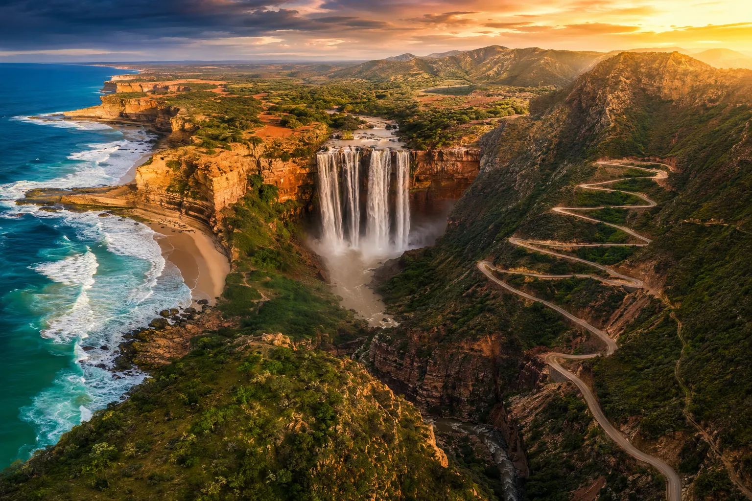
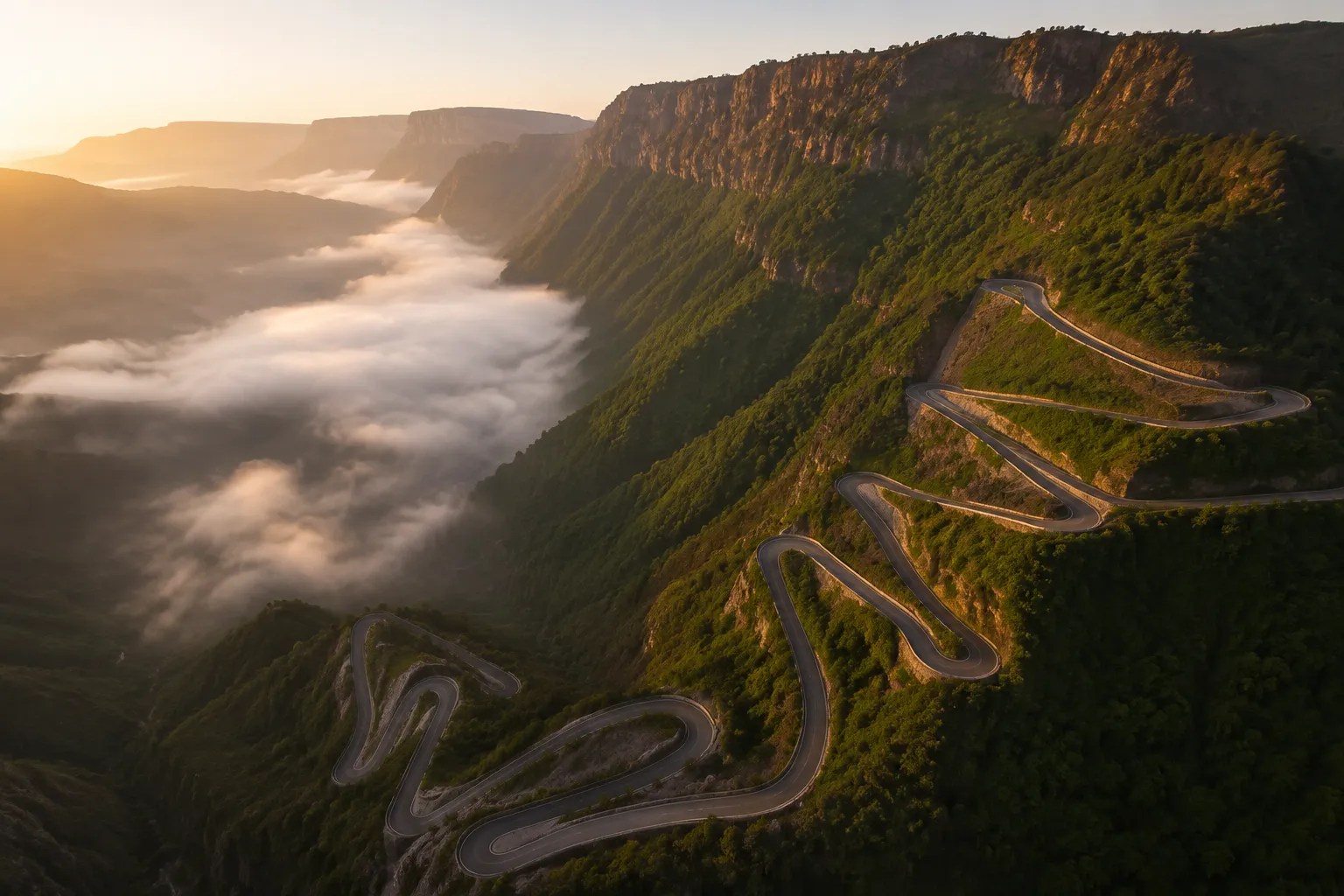
The Serra da Leba is a 30 km stretch of dramatic hairpin road that descends from the Huíla Plateau (around 1,845 m) down to the coastal lowlands leading to Namibe. Its signature switchbacks form one of the most photographed views in Angola [3][8].
How to visit:
- Hire a driver or 4x4 in Lubango (a half-day trip usually runs a few hours)
- Head west on the EN-280 road toward Namibe
- Stop at the miradouro (viewpoint) at the top of the pass for the classic curved-road photo
- Best light is early morning before mist rolls in, or late afternoon
- Continue down if you want to combine with a trip to Namibe province
Pro tip: The viewpoint at the top is unmissable, but the road itself is the real experience. Sit on the right side of the vehicle heading down for the best window views.
The road was engineered in the 1970s and remains a functioning trade route, so expect trucks. Drive carefully and don’t stop on blind bends.
Tundavala Gap Lubango: hiking and viewpoints
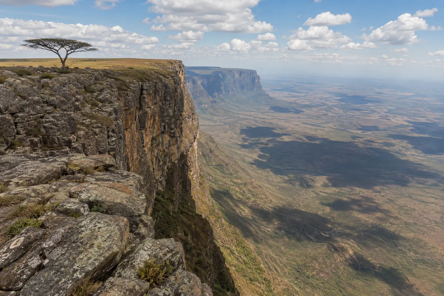
The Tundavala Gap, or Fenda da Tundavala, is a 1,200-meter escarpment where the Huíla Plateau ends abruptly in a sheer cliff. Located about 18 km northwest of Lubango, it offers views stretching tens of kilometers across the lower plains toward Namibe [2].
What to expect:
- A short drive on a partially unpaved road from Lubango (roughly 30 to 45 minutes)
- A gently sloping approach that suddenly opens onto the abyss (surprise factor is huge)
- Scattered viewpoint rocks you can walk right up to (no railings, so be careful)
- A challenging 6 km hike option along the rim with steep sections and loose terrain [7]
The drop is genuinely vertiginous. Bring a windbreaker (it’s often cold and gusty), sturdy shoes, and water. Sunset here is legendary, but leave before dark since the road back has no lighting.
Common mistake: Getting too close to the edge for photos. There are no barriers, the rock can crumble, and there is zero cell reception if something goes wrong.
Cristo Rei of Lubango
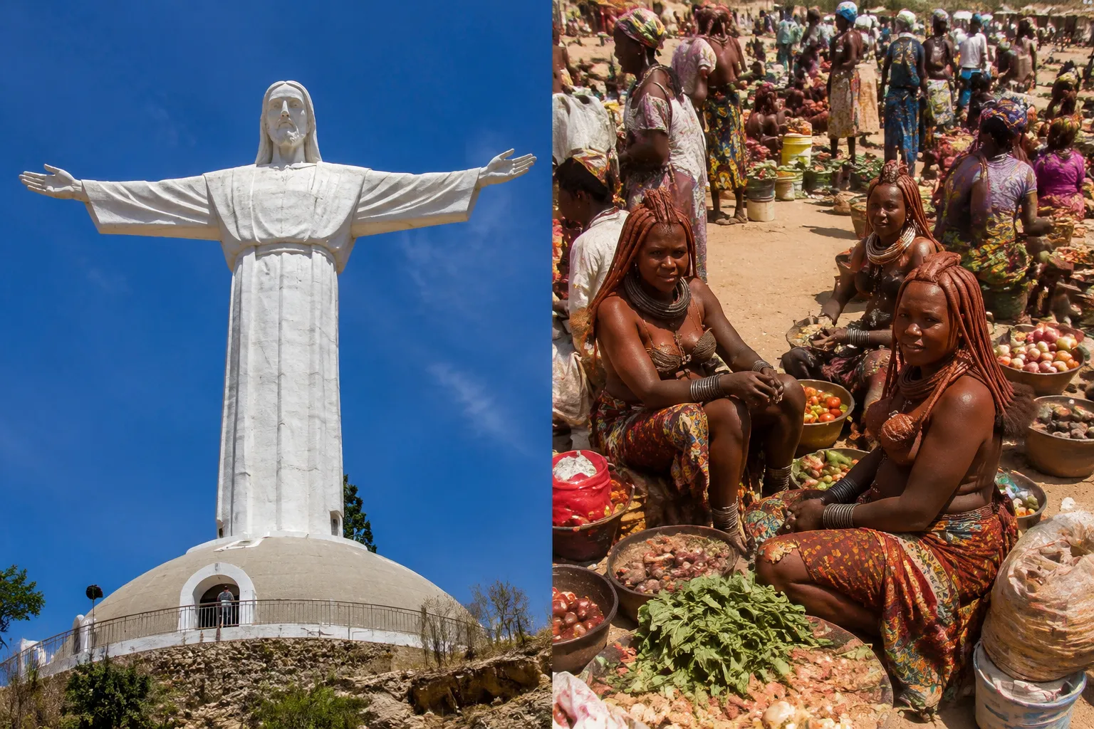
The Cristo Rei statue is a 30-meter white sculpture overlooking Lubango, modeled after Rio de Janeiro’s Christ the Redeemer and completed in 1957 [4]. It sits on a hill just south of the city and is reachable by a short paved road (or a steep walk if you’re up for it).
The panorama covers the whole city, the surrounding Serra da Chela mountains, and on clear days you can trace the shape of the plateau all the way to Tundavala. It’s a great orientation stop at the start of your visit.
What to do in Lubango besides hiking
Beyond the big three viewpoints, Lubango offers cultural experiences, colonial architecture, and easy access to southern Angola’s wildlife and desert areas. Most travelers spend two to four days here.
Ideas to fill your itinerary:
- Chibia and Hoque markets (Saturdays): meet Mwila people in traditional beaded attire and elaborate ochre-clay hairstyles [3]
- Festival de Lubango in August: parades, live semba and kizomba, food fairs [4]
- Colonial center: stroll around the old cathedral and the tree-lined avenues
- Nossa Senhora do Monte chapel: another hilltop viewpoint, less crowded than Cristo Rei
- Day trip to Humpata plateau: cooler farmland with Boer settler history
- Extend south to the Iona National Park or the Namib desert via Namibe
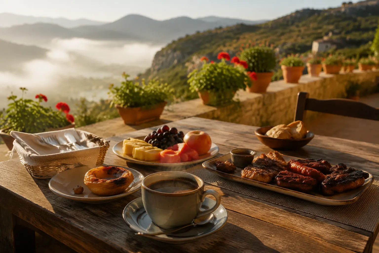
For food, try highland Portuguese-influenced dishes: grilled meats, hearty stews, and Angolan staples like funge and muamba. Explore more on the Angolan cuisine page.
Lubango altitude and why it’s cooler than other parts of Angola
Lubango sits at 1,760 meters on the Huíla Plateau, and altitude is the reason it feels nothing like tropical coastal Angola. Temperatures typically range from 15°C to 27°C with low humidity and clear dry-season skies [4].
Nights can drop below 10°C in June and July, so pack layers. Compare that with Luanda’s sticky 25 to 32°C year-round and you’ll understand why highland Angola has always been popular with settlers, farmers, and now travelers seeking relief from the coast.
Lubango climate and weather: what to expect
Lubango has a mild highland tropical climate with two clear seasons: a dry, cool season from May to September and a wet, warmer season from October to April. The dry season is prime tourist time [4].
| Month | Season | Temp (°C) | Best for |
|---|---|---|---|
| May, Jul | Dry, cool | 10-24 | Viewpoints, hiking |
| Aug, Sep | Dry, mild | 14-27 | Festivals, photography |
| Oct, Dec | Shoulder/wet | 15-27 | Green landscapes |
| Jan, Apr | Wet | 15-26 | Fewer tourists, cloudy views |
Choose May to September if you want clear panoramas and predictable dry weather. Choose the shoulder months if you don’t mind occasional rain and prefer lush green highlands.
How to get to Lubango from Luanda
The two realistic options are flying (1.5 hours) or driving (10 to 13 hours). Most travelers fly.
By air: TAAG Angola Airlines operates daily flights from Luanda to Lubango’s Mukanka Airport (SDD). Flight time is about 1.5 hours [6]. This is by far the easiest option. Learn more about carriers on our flights-to-angola guide.
By road: The drive from Luanda covers roughly 1,000 km via the EN-100 coastal highway and inland routes. Realistic driving time is 10 to 13 hours depending on road conditions and stops, and it’s rarely done in one day. Splitting the trip with a night in Benguela or Lobito makes far more sense. Check our Angola itinerary page for itinerary ideas.
By road from Benguela: A more manageable 5 to 6 hours [6].
Affiliate disclosure: Below are booking partner links. We may earn a small commission at no cost to you. Links marked as sponsored.
Compare flight options with our booking partner (search flights to Lubango) and hotels in the city (check Lubango accommodation).
Lubango vs other Angola destinations: which is better?
Lubango is the top pick for scenery and cool weather. Luanda wins for nightlife and history, Benguela and Lobito for beaches, and Kalandula/Malanje for waterfalls. Most travelers combine two or three regions.
Choose Luanda if you want urban culture, museums, and coastal city life.
Choose Benguela or Lobito if beaches and colonial coastal charm top your list.
Choose Kalandula or Kissama if waterfalls and wildlife safaris are your priority.
Is Lubango safe for tourists?
Lubango is generally considered one of the safer cities in Angola for tourists, but standard precautions apply. Petty theft can happen, and remote viewpoints like Tundavala should be visited during daylight with a local driver or guide [5].
Practical tips:
- Don’t display expensive electronics or jewelry in public
- Use registered taxis or a hired driver rather than walking at night
- Skip Tundavala after sunset (no lighting, no phone signal)
- Carry copies of your passport and visa
- Check current government travel advisories before departure
For an up-to-date safety picture, see our is Angola safe overview and always cross-check with your national foreign ministry.
Lubango accommodation: where to stay
Lubango offers a solid range of mid-range and upscale hotels concentrated in the city center, giving easy access to Cristo Rei, restaurants, and day-trip departure points [6]. There are no true luxury international-chain resorts, but comfortable business-class hotels are common.
Neighborhood pointers:
- City center: Best for restaurants and walking around; most hotels are here
- Near Cristo Rei road: Quieter, better views, need a car
- Humpata: Rural guesthouses on the plateau, great for nature lovers
Book ahead for August during the Festival de Lubango, when rooms fill fast. Compare Lubango hotels with our booking partner.
Common mistakes visitors make at Serra da Leba
The Serra da Leba is safe and accessible, but travelers still trip themselves up. The most common mistakes are timing, footwear, and expectations.
- Arriving at midday: Harsh light flattens the photo and haze often blocks the view. Go early morning or late afternoon.
- Stopping on the road itself: The pass is a working trade route with trucks. Use the marked viewpoint.
- Skipping Tundavala because you’ve already seen Serra da Leba: they’re completely different experiences (a road pass vs a plateau edge), and both are worth it.
- Not layering up: Highland winds are cold even in the dry season.
- Assuming there’s a café at the top: Facilities are minimal (though the 2026 government tourism upgrade should improve this) [1].
Conclusion
Lubango is the destination that changes how travelers picture Angola. Cool highland air, cinematic mountain roads, sheer plateau edges, and a laid-back city center make it a genuine highlight of any Angola itinerary. If you have a week or more, combine Lubango with Namibe’s deserts and a coastal stop in Benguela for a well-rounded southern route.
Next steps:
- Verify current visa and vaccination requirements via Angola visa guide and vaccinations in Angola
- Book a TAAG flight from Luanda well ahead for dry-season travel
- Reserve accommodation in central Lubango, especially for August festival dates
- Hire a local driver for Serra da Leba and Tundavala day trips
- Check the latest official travel advisory (WHO, national foreign ministry) close to departure
For deeper planning, browse our travelling to Angola hub.
Free help from our team in Angola
Planning a trip to Lubango?
Tundavala and the Serra da Leba are best seen with a local driver. Tell us your dates and we arrange the flight from Luanda, the car, a guide and your hotel.
- Local team in Angola
- No obligation, nothing to pay
- Reply by email or WhatsApp
Want to keep this guide? We email you the key points with a link to every section.
Frequently asked questions
Where is Lubango?
Lubango is the capital of Huíla province in southwestern Angola, on the Huíla Plateau at 1,760 m altitude, about 1,000 km south of Luanda.
What is Lubango known for?
It's known for the Serra da Leba mountain pass, the Tundavala Gap escarpment, the Cristo Rei statue, and its cool highland climate. It's also the cultural heartland of the Mwila people.
What is the Serra da Leba?
A dramatic mountain pass with famous serpentine hairpin bends connecting the Huíla Plateau to the coastal lowlands. It's one of Angola's most photographed sights.
What is Tundavala?
Tundavala (Fenda da Tundavala) is a 1,200-meter escarpment about 18 km from Lubango where the plateau drops sheer into the plains below. It offers panoramic views for tens of kilometers.
How do I get to Lubango?
Fly from Luanda with TAAG (about 1.5 hours) or drive roughly 10 to 13 hours via the coastal highway. Flying is the standard choice.
Best time to visit Lubango?
May to September, during the dry season, for clear skies, mild temperatures (15 to 27°C), and best visibility at Serra da Leba and Tundavala.